
Forecasters: Gusty winds, heavy mountain snow still on track for central Montana
High wind gusts, heavy mountain snow along the Continental Divide, and a decent dose of lower-elevation snow remain on track to affect Lewis and Clark County and the surrounding area through Saturday evening, according to forecasters.
While the wind was somewhat calm around sunrise in Helena, a gust of 68 mph was reported at the Helena Regional Airport not long before 10 a.m. Wind gusts topped 60 mph on MacDonald Pass and Flesher Pass. Further north near Cascade and Choteau, morning winds were in the 40-mph range, gusting up to 60 mph.
What started primarily as a windstorm on Thursday is expected to turn into one of the heaviest snowstorms of this winter heading into the weekend, particularly along the Continental Divide and in central Montana's island mountain ranges.
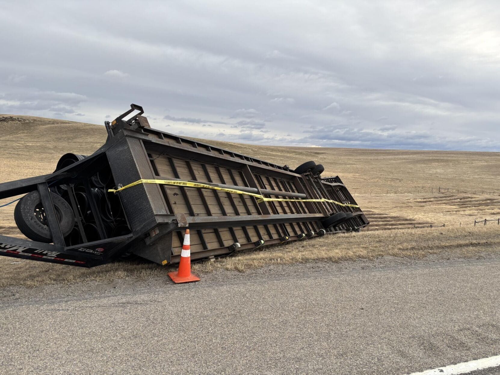
Blown-over semis and vehicles with trailers were reported from the Continental Divide east through central Montana on Thursday. A flipped trailer blocked Highway 287 near Winston Thursday morning.
In Wheatland County, the sheriff’s office responded to three semi-truck rollovers with injuries. Montana Highway Patrol closed U.S. Highway 191 north until conditions improved.
Fergus County declared a state of emergency because of the wind and expected snow.
“We aren’t just reacting to the storm; we are getting ahead of it,” the county’s emergency services department said in a social media post. “By declaring an emergency now, we ensure that every resource is available to keep Fergus County moving—and to help you ride this out safely.”
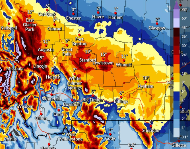
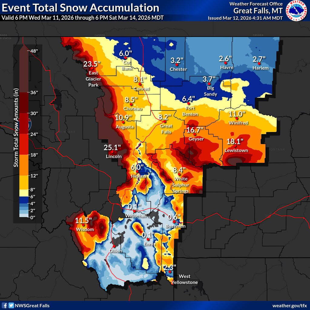
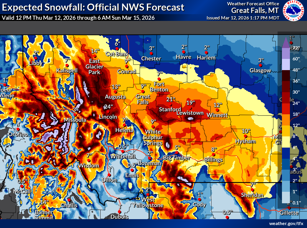
An updated forecast from the NWS showed Lewistown is expected to get 19 inches of snow in the storm. Stanford, to the west, is forecast to see 21 inches of snow.
The next couple of days will bring the heaviest snow the area has seen for most of the winter, according to forecasters, and most of central Montana is under winter storm warnings until Saturday evening.
In Helena, 3-8 inches of snow is expected through Saturday evening. Surrounding higher elevations could see 8 to 12 inches of snow, and the highest elevations could see 18 inches or more in Lewis and Clark and Jefferson counties.
The Upper Blackfoot, MacDonald Pass and Rogers Pass areas, also including Lincoln and Marysville, are expected to see 10 to 20 inches in the storm. As of Thursday afternoon, Lincoln was forecast to get 19 inches of snow through Saturday.
In Choteau, Great Falls, Canyon Creek, Wolf Creek and Craig, total accumulations are expected to be 6 to 10 inches in the storm.
The Crazy Mountains are expected to get 1 to 3 feet of snow in the full storm, with wind gusts up to 90 mph on Thursday evening, the NWS said.
Marias Pass had already received nearly 9 inches of snow by 1 a.m. Thursday, and Teton Pass Ski Resort reported 14 inches of snow just before 8 a.m.
The Blackfeet Tribal Business Council declared a state of emergency Thursday morning because of the severe cold, strong winds and flood concerns. The tribe has set up a warming shelter at Stickgame Arbor that will be open at 4 p.m. March 11 through 15. If needed, Browning Middle School will serve as an alternate location.
Exactly where an incoming cold front ends up will be a factor in how much low-elevation snowfall the area gets. Some stronger winds are expected along with snow on Saturday, according to forecasts.



Comments ()