
GIS research on snow aims to prevent future rooftop collapses
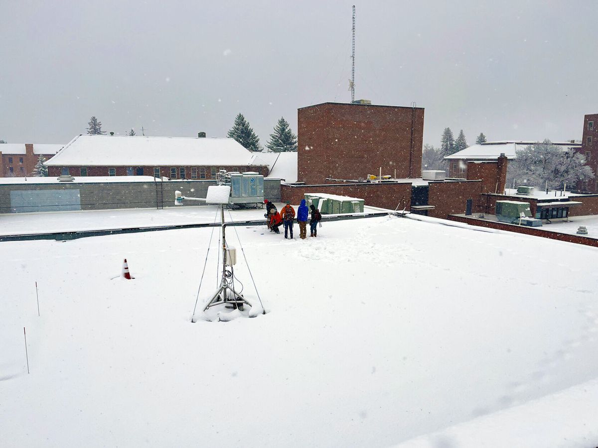
In the winter of 2019, the roof of the North and South gyms of the Marga Hosaeus Fitness Center collapsed after unprecedented heavy snowfall. Now, researchers and undergraduate students are using geographic information system (GIS) technology to prevent future collapses.
Eric Sproles, assistant professor of the Department of Earth Sciences, approached university facilities after the roof collapse to gauge if his work in GIS would help measure rooftop snowfall. “We usually map and measure snow in the field, but it’s actually a lot easier to do it on a rooftop,” Sproles said.
A GIS takes information and distills it into a map, Sproles said.
“We’re taking a location-based measurement of snow density and then we’re able to take millions of measurements of snow depth and integrate those to make a map of snow density across rooftops,” he said.
The project involves a couple of different components. The first is a snow scale, which was installed on the roof of the Strand Union Building (SUB). The snow scale works similarly to a regular weight scale you might have in your bathroom, Sproles said. But in this case, the scale measures the mass of snow. Once the mass and the area of the roof are determined, snow density can be calculated. The scale measures continuously, so the project receives data throughout the year.
The second component of the project is drone flights, which can record the differences in snowpack between the middle of rooftops and the edges, Sproles said. Undergraduate students often operate drone flights.
“You want a lot of dates throughout the year, but you also want to capture the big snow events because that’s when you’re going to have the best data,” said Sam Neitlich, a senior in environmental science who joined the project in the winter of 2021.
The drone flights take place about every two weeks or after large snow events, Neitlich said, and are often set on a flight plan for ease. The drones also use a Light Detection and Ranging (LiDAR) system to measure snow depth. A LiDAR system sends photons from the transmitting system — in this case, the drone — to objects from the scene and rooftop snow, Neitlich said. The reflected light is detected by the system receiver and is used to develop a distance map.
Once the interactive maps are put together, facilities can determine snow removal plans, Sproles said. Furthermore, tension sensors are also installed on the roof to measure the flexing of the roof when it snows. “When the pounds per square feet are x, the roof of the SUB flexes y,” Sproles said. Now, the interplay between snow load and how the roof responds can be measured to prevent future collapses. “It all happens in real time, and that’s something that didn’t exist before,” Sproles said.
Currently, the project measures snowpack on the roofs of the SUB, Leon Johnson Hall and the Museum of the Rockies. “The overall goal is to provide better information to facilities,” Sproles said. “We aren’t making maps, we’re regenerating knowledge and science.”
Comments ()