
Winds hammer Montana east of the divide; forecasters say more is in store
High winds battered Montana east of the Continental Divide over the weekend, causing an out-of-control grass fire and an elementary school to lose its roof.
Meteorologists say more is in store.
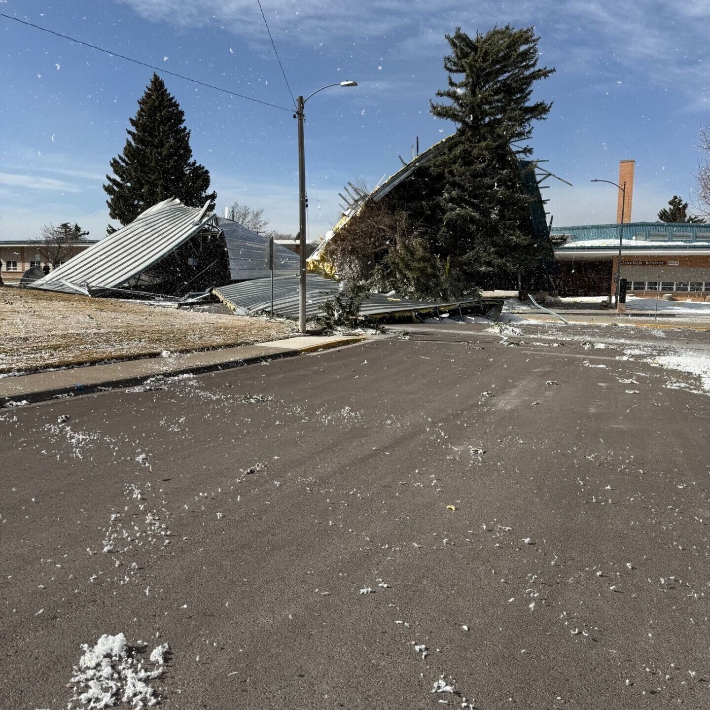
In Great Falls, damaging winds took part of Lincoln Elementary's roof off on Sunday, leading to a school closure Monday and Tuesday. Video and images circulating social media show a piece of the school's roof turned over and crumpled as insulation blew in the wind.
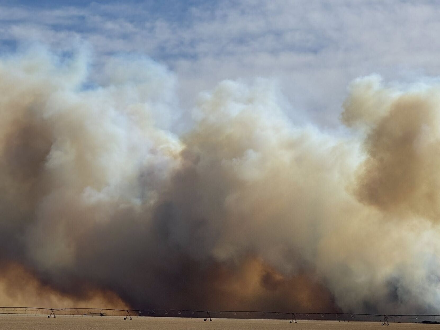
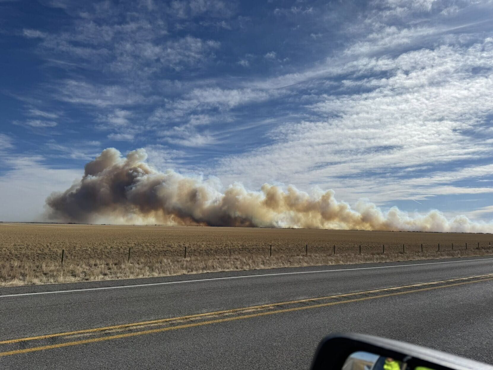
Outside Choteau, the winds stoked a grass fire to 500 acres on Sunday, according the Montana Department of Natural Resources and Conservation. The cause of the fire, named the Eldorado fire, was undetermined as of Monday.
The fire forced the closure of U.S. Highway 89 for a period of time Sunday, according to the Montana Department of Transportation.
"Montana’s wildland firefighters are on the front lines today, battling fires fueled by these high winds," Gov. Greg Gianforte posted on Facebook Sunday. "Susan and I are praying for their safety and for all Montanans in the path of these winds."
On Sunday, Great Falls recorded its highest wind speed at 54 mph and highest gust at 73 mph. Helena's highest recorded wind speed was 46 mph and highest gust was 67 mph.
The forecast
According to meteorologists with the National Weather Service's Great Falls office, this week's weather is forecast to be very active and unsettled. Weather systems are expected to bring "daily chances for precipitation, seesawing temperatures, and numerous days of strong to potentially high winds."
Key message from the forecast:
- Strong and gusty winds develop once again from the late morning through early evening hours on Monday.
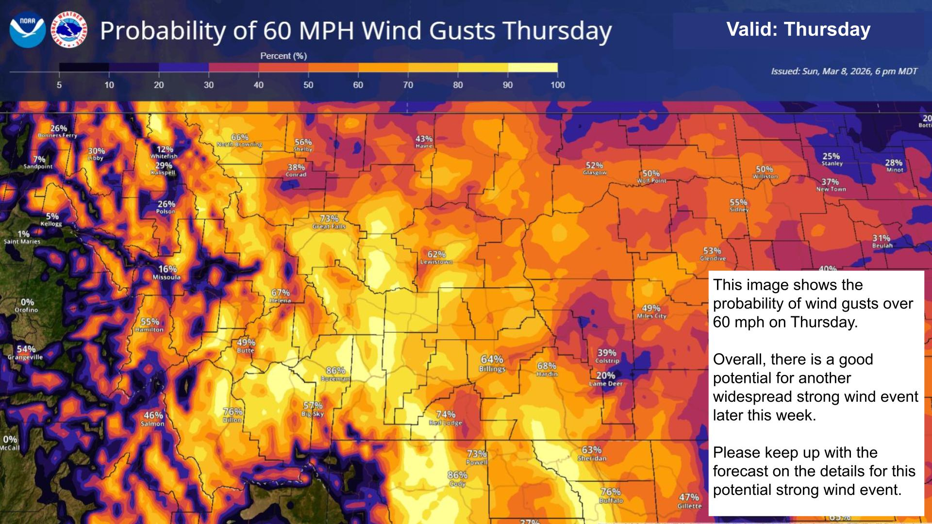
- Another significant wind event is possible from Wednesday night through Thursday night.
- Heavy mountain snowfall is possible from the end of the work week to through the first half of the weekend, especially over the Continental Divide.
Of particular concern to forecasters will be the period from Wednesday afternoon through Saturday afternoon when a plume of Pacific moisture will stream eastward and over the Northern Rockies.
"This Pacific moisture will bring heavy mountain precipitation, primarily in the form of snow, and strong winds, particularly from Wednesday night through Friday morning," the NWS office's weekly hazard briefing reads.


Comments ()